Friday, April 4, 2014

Cordillera to Sierra Madre [Day 3 and Day 4]_Motorcycle Riding

Cordillera to Sierra Madre [Day 3 and Day 4]_Motorcycle Riding

Day 3: Sagada to Isabela
Date: February 19, 2014
Route Taken: Sagada – Bontoc – Barlig – Natonin- Paracelis – Ifugao – Maris Dam – Magat Dam – Santiago – Echague, Isabela


     Woke-up around 7:30 in the morning, took my breakfast of bread and water, plot my route and prepare myself for today’s adventure.

    Past 9AM when I left the hotel. Drop by at the church in Poblacion to have some prayers and pictures as well.


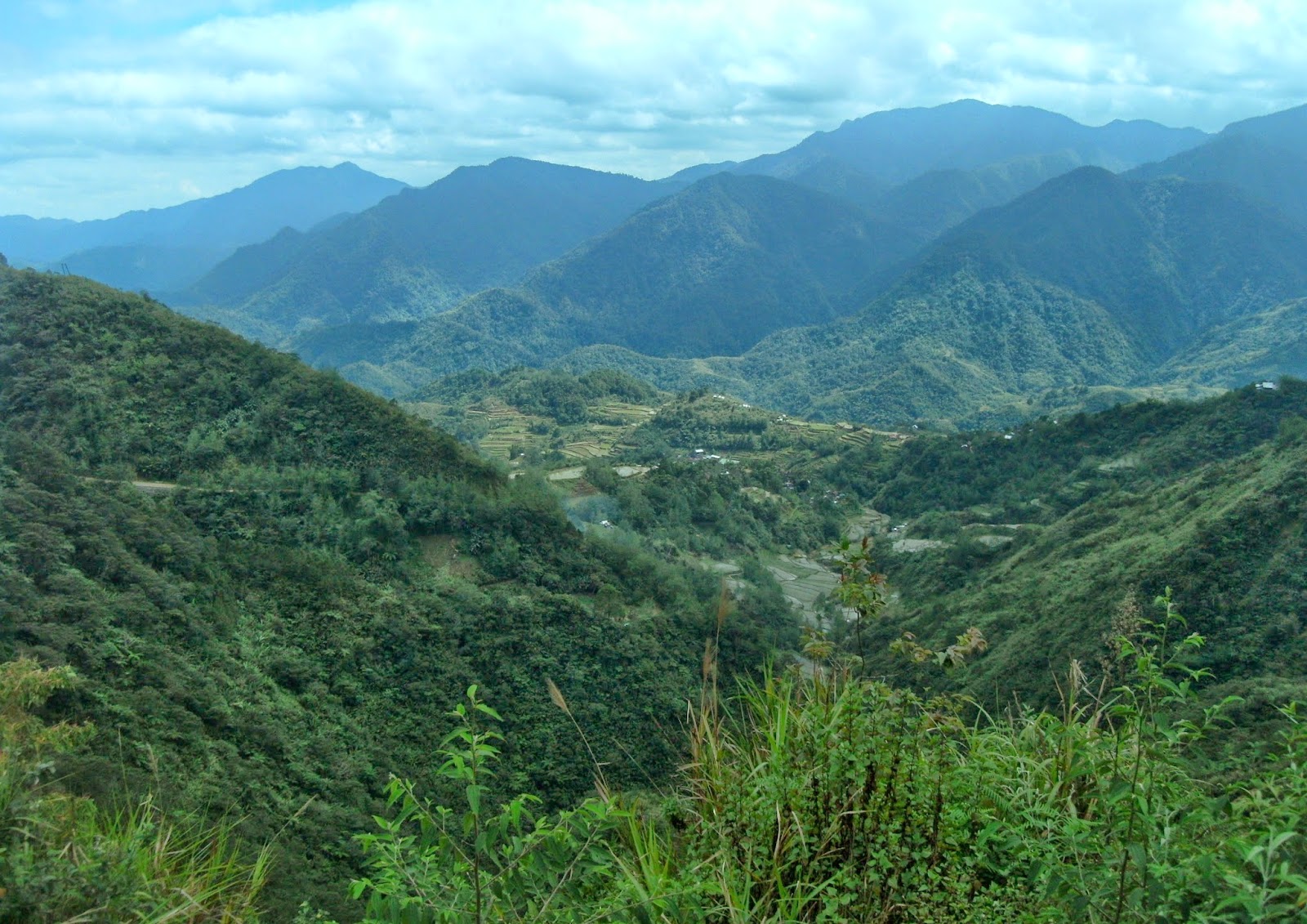
     Then I started rolling heading Bontoc. I know that this segment is a very long off-road and far from city civilization so I told myself to at least lessen the stops and picture taking for me to complete the route before sundown. But there are some points that I can’t resist pulling over to have a sneak to the beauty of Cordillera Mountain Ranges such like this.


     I continued riding heading East direction going to Barlig. My next stop is on top of these majestic rice terraces. The Barlig Rice Terraces which is part of Cordillera Rice Terraces that was acknowledged and inscribed by UNESCO to showcase the ingenuity of Igorot engineering.


     After few more clicks from my camera, continued riding heading Natonin. From Barlig, it is already a complete and challenging off-road condition. Lucky for me that it is summer time so the bumpy road is dry and more manageable. Few kilometers from Barlig, I found myself riding alone in the middle of the mountain. Anywhere you point your eyes; it’s all mountain, and mountain, and mountain. What should to expect, this province is called Mountain Province.


     From Barlig to Paracelis, it has approximately 70kms of complete off-road. But from Paracelis, it is already 99% paved roads up to Isabela. Continued riding with no stops until I reached Isabela proper aiming to arrive on this province while the sun is still high.
     I’ve drop by at the two dams in the boundary of Ifugao and Isabela for few more pictures before going to Santiago to look for place to stay.

   Maris Dam:


Magat Dam:


     Past 5PM when I arrived in Santiago, Isabela. Looked for a place to stay, but as expected, hotel inside the city are more pricey than the nearby Municipality. So I decided to travel 10 more kilometers going to the nearby Municipality of Echague where I found a cheaper room worth P450 for overnight stay compared to P800 to P900 in the city.


      After I settled my room, looked for something to eat, looked for gas station to fill the bike’s tank. Had few bottles of beer and I ended the day.


:: End of Day 3 ::


Day 4: Isabela to Dinggalan, Aurora
Date: February 20, 2014
Route Taken: Echague, Isabela – Jones – Maddela – Dinadiawan, Aurora – Dipaculao – Maria Aurora – San Agustin – Bongabon, Nueva Ecija – Laur – Dinggalan, Aurora


     Get-up from the bed past 7AM, lubricate the bike, prepare myself and left the hotel at 9AM.
     I was assessed the previous day that I almost short of budget so I asked helped from my friend Rey who’s in Manila to send me some thousand bucks and he remit it to Cebuana Lhuiller yester night. So first destination after I left the hotel is to look for Cebuana Lhuiller in the area to claim the money.
     After that errand, I started rolling via the Echague backdoor bypassing the National Highway going to Maddela.


     In Madella, I dropped by to a known tourist attraction at this municipality, the “Maddela Waterfalls”. It is 3kms away from the main road. The 3km road are off-roads but manageable that you can even bring your sedan to the area.
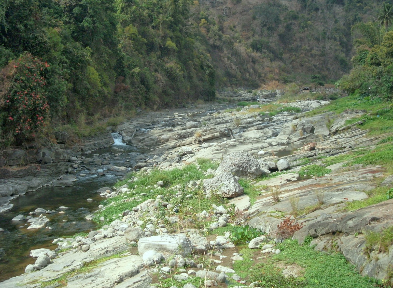
     Maddela Waterfalls is a series of falls with basins below each falls for swimming. Others called it “Governor’s Rapid”. They have curved the stones to form natural steps for easy access going to the other falls above the hill. I was able to reach 4 waterfalls and basins. I believe there are more surprises and adventures above of it but the terrain is more difficult and stiff and I don’t have more time to explore so I enjoyed relaxing for few minutes on the last rapid that I’ve reached.


      It’s almost lunch time and I am not even at the half of this day’s route. This lap is one of the longest laps of the entire trip so even I still wanted to stay; I need to move forward because I am still too far to my today’s destination, in Dinggalan, Aurora.
     I get back on the road again traversing the mountainous terrain on the boundary of Isabela and Aurora. This is now part of the Sierra Madre Mountain Ranges that’s why I titled this trip as “Cordillera to Sierra Madre”. There is an on-going construction on this part of the mountain with only approximately 20kms off-road left and I believe this can be completed the soonest.
     From Dinadiawan, Aurora to Baler is already 100% complete paved road. It is nice traversing this part of the road because it is a coastal road at the East Side of Luzon. I was even tempted to pull-over and touch the salt water because of the beautiful view and this was my first time to see body of sea water again after 4 days since I left Manila.


     Then continued riding heading Maria Aurora bypassing Baler proper. I been to Baler and Maria Aurora years back but I missed to visit this said “Century Old Balete Tree”. So I made it sure to put it on my itinerary this time.


     I enjoyed roaming around the area, passing through small openings to get inside or in the middle of the tree, climbing on top, picture taking and chatting with the locals when I noticed it is already 4 o’clock in the afternoon.
     Part of my route is the Villa to Bongabon road which I believe is a 70kms off-road with river-crossing so I need to move now to complete traversing this segment before sundown.


     Lucky for me that construction on this area is also on-going and there’s already around 20kms off-road left, so I was able to reach the Nueva Ecija – Aurora boundary right just in time that the sun is kissing the edge of the mountain.


     I arrived in Bongabon past 7pm. Heavy rain falls when I arrived in Bongabon so I put the electronic gadgets inside the bag with plastic for waterproofing. Passing through the mountainous area of Laur – Dinggalan road on heavy rainfall, cold weather, total darkness with small amount of light coming from a dirt bike really slows down my pace, but manage to arrive on my destination safe around 8:30PM where I met my father Allen to join with me on tomorrow’s adventure.
    Had some beers and chatting with my father before we hit the bed to rest our body in preparation for tomorrow’s more adventurous and final segment of this ride.


::  End of Day 4  ::

Friday, March 21, 2014

Cordillera to Sierra Madre [Day 1 and Day 2]_Motorcycle Riding


Day 1: Manila to Mt. Santo Tomas via Tubao
Date: February 17, 2014
Route Taken: Taguig – Bulacan – Pampanga – Tarlac – Pangasinan – La Union – Baguio via Asin Rd. – Mt. Sto. Tomas


     Almost every year, as a year starter, I always try to find spare time to travel on place or route that is new to me. And this time, I choose it to be in the mountainous area to feel the cold weather before the heat of the summer comes. And it is in the mountains of Cordillera and Sierra Madre.

     A week before, I already prepared the bike by bringing it to the motorcycle mechanic for tune-up, replace the rubber, align the wheel and even replacing the bearings and the speedometer gear.

     A night before takeoff, I was still busy reviewing the map and reading some articles regarding the places that I will be going. Adding the high energy level and great excitement, it was a sleepless night for me until I noticed that it is already 2 o ‘clock in the morning. No more time for me to have a nap, so I start preparing myself and pack my things.

     Four in the morning, I heat-up the engine, took the saddle and hit the road heading north. Somewhere in Pampanga, I started to feel sleepy and a bit dizzy. From time to time, I pull over to the shoulder to have at least a minute of rest.


     At the start, a minute of rest is helping me, but as the sun goes up, I can’t resist closing my eyes and there are instances that I need to pull-over to gasoline stations to have a nap or coffee break.


     Slowly, kilometer by kilometer, minute by minute, I made it to Rosario La Union where I had my lunch and 30 minutes break which really helped me to recharge. There I also refueled the bike before hitting the off-road of Tubao La Union.

   From Tubao, my sleepy eyes didn’t showed anymore as I enjoyed the beautiful sceneries of the mountains, river, streams and other landmarks along Asin Road going up to Baguio.

     Tubao River:


     Tuba River in front of Tuba National High School:


     Asin Road Tunnel:


     Mini-falls along Asin Road:


     Shrine of Brown Madonna:


     I just go straight the Asin Rd. and it ended me up in Marcos Highway in Baguio. I decided not to go to Baguio proper to avoid the traffic congestion in the area, and instead headed the way to the road to Mt. Santo Tomas.

     The first time I went on this mountain is during our educational trip in college. Mt. Santo Tomas is where telecommunications, relay stations and radio communication towers are located to have a good elevation. During that time, I was able to reach the summit of Mt. Santo Tomas by foot. So this time, I told to myself, I want to go up there with my motorcycle.


     Reaching the summit with my bike is not that easy. The rocky trail with a bit of inclination is already technical terrain for me. I experienced falling on my bike, but it didn’t stop me from achieving my personal goal for today, to reach the summit with my bike. And I did it.


Pictures from the summit of Mt. Santo Tomas:


     After bunch of photo shoots at the summit, I decided to go down right just before the sun sets to Mt. Cabuyao where there’s a secured area to pitch your tent which they call, “Picmar Heritage Lodge”. You can rent a room for minimum of 2 persons worth P1200. But I choose to rent a space for my tent worth only P150.


     I ate my dinner and had some beers which I bought in Marcos Highway before going up. Past 10PM when I hit the sack and enjoyed sleeping in a very cold and breezy mountain of Cordillera.


:: END OF DAY 1 ::


Day 2: Mt. Santo Tomas to Sagada via Kabayan
Date: February 18, 2014
Route Taken: Mt. Santo Tomas – Baguio – Binga Dam – Ambuklao Dam – Bokod – Kabayan – Buguias – Mountain Province – Sagada


     Already awake past 6am, but went out of the bag around 7am. Had a coffee from a vending machine at the house of the caretaker, took pictures of the beautiful sunrise and roam around.


     Inclusion of the P150 tent space fee is a free use of their bathroom. I would like to take a shower first before departing but it is still very cold at this early morning, so I decided to go to the highest point of this mountain where the PAGASA radar is located, by running to heat me up.
     From that location, you can have the overlooking view of Western side of Pangasinan with the West Philippine Sea in the background. At the Northwest side, added to the view is the man-made lake of Mt. Cabuyao which I believe they use this as a water source for their plants and crops. And of course at the opposite side in the South direction is Mt. Santo Tomas.


     After I heated up, I can almost tolerate the cold water to have a bath. Past 9am when I break camp and packed my things. Wave goodbye to the caretaker and hit the road again heading Northeast via Ambuklao road.
     Part of the plan is to visit Binga Dam which I haven’t been before. Binga Dam is a 9km off-road from the main road, so it added-up additional 18kms on my off-road adventure.


     After few more pictures and some minutes of rest at Binga Dam, I travel back to the main road heading Ambuklao Dam.


     After Ambuklao Dam, I continued riding heading Northeast then turn left going to Bokod Benguet. In Daclan, Bokod, there is another 2km side trip from the main road to visit the “Badekbek Sulfur Spring”. This is a high temperature natural spring where you can see it is actually boiling and you can see its smoke even from a far. Visitors are joking on it that if a pig or cattle accidentally dropped on this boiling water, it can immediately cooked and ready to eat.


      Few more pictures and I went back to the main road again. Passed-by the intersection going to Mt. Pulag and continued riding towards Kabayan, Benguet, where they are saying that old mummies are still culturally preserved.
     Unfortunately, for me to see the good preserved mummies, I need to hire a guide and hike 2 hours going on top of the mountain, but I’m in a time constraint. So I just went to the mummy museum within the town proper. But… it’s really unfortunate that the museum is closed today because the caretaker went out of town. So I just had my pictures of the museum outside without even a sneak of the said mummies [but I told to myself that I will be back and I will go up to the mountain to see those mummies].


     Had some rest in the area, took my lunch of chocolate and bread then continue riding intended going to Mountain Province via Buguias, Benguet.
     I can’t really tell if this is another misfortune because I got lost and I found myself approaching Ifugao area. I missed the intersection going to Buguias 30mins away. But the good thing happen is I got an opportunity to see and have some pictures of this lake which they called “Tabeo Lake”.


     Asked the locals for the correct direction and it made me went back to the correct track. I arrived in Mountain Province boundary at around 4:30PM.


     Past 8pm when I arrived in Sagada Poblacion safe. There is another misfortune of flat tire experience in total darkness, but still managed to find help from the locals.


     Town of Sagada has local ordinance that establishments and restaurants are closing at exactly 9PM, so the first thing I did after securing my lodging is looked for my dinner. Was able to have 2 bottles of beer then took the bed at 10PM and enjoyed sleeping in the cold night on a more comfortable bed compared to last night for only P250.


::  END OF DAY 2  ::