Day 3: Abatan, Benguet to
Banaue, Ifugao
Date: March 30, 2015
Route Taken: bike repair at
Abatan – Abatan, Benguet – Bontoc – Banaue
Good morning Abatan…..


As per planned, after breakfast, we looked
first for a trusted mechanic who can help us troubleshooting and fixing the
problem on Dad’s bike. As recommended by the locals, and as also confirmed by a
co-rider and MCP forumer Ithcyfortravel, we found a Honda Authorized Shop just
in the center of the busy Poblacion of Abatan.

Since
we dedicate the half of this day for motorbike maintenance, I also took the
chance to have my bike checked because I am having minor problem with my bike’s
breaklight. It’s around lunch time when bike repairs got completed. Took our
lunch and prepared ourselves then started rolling again aiming to at least
reach the town of Bontoc for the other half of the day. Very few stops and one
of them is in Benguet - Mountain Province boundary.

More pictures along Halsema
Highway heading Bontoc:


This
is the famous mini-tunnel in Halsema Highway
before reaching the town of Bontoc. Years ago, sometime in 2006 when I first
passby on this area of Halsema, the road is not cemented yet and the concrete
road on the right side of the tunnel is not yet constructed. All vehicles are
passing inside the tunnel one-way at a time as 2-way traffic is not possible.

The original plan is to go to Bangued,
Abra from Bontoc via Tinglayan, but due to time constraint, we decided not to
push through and instead, diverted the plan going to Kabayan, Benguet via
Banaue-Kiangan-Tinoc. Around 3:30PM when we arrived in Bontoc. The sun is still
high and Banaue is approximately 60kms only from Bontoc,
so we continued riding because we’ve estimated that we can arrive in Banaue
before dark which could be around 6PM.

This road intersection is the road
going to Barlig and Natonin. Last year when I pass through this
road, it is still rough road. Construction is really fast that it looks like
fully completed to date. Few more years and it can be another biker’s haven
enjoying the twisties of Cordillera going to Paracelis.

Bay-Yo Rice Terraces:

More views along Bontoc –
Banaue Road…..


Banaue Rice Terraces:

We arrived in Banaue
before the sun sets. Exact time as our estimated time of arrival which is at
6PM. Looked for place to stay, had our dinner, taste the locally brewed wine
(rice wine) and we ended the day.

==
END OF DAY 3 ==
Day 4: Banaue, Ifugao to Kabayan,
Benguet
Date: March 31, 2015
Route Taken: Banaue –
Kiangan – Tinoc – Bugias – Kabayan
Good morning Banaue!!!...
Prepared ourselves and our bikes, took our
breakfast and we left the hotel at around 9AM.

Continue travelling towards Lagawe and to Kiangan as
our first stop for the day.

We’ve visited the most famous tourist
destination here in Kiangan, Ifugao which is the Kiangan Shrine.
This is like a smaller version of the Shrine of Valor in Bataan where it shows
the braveness of the Filipino soldiers during World War II. This became a
famous landmark because it was said to be the place where the Japanese highest
Commander, General Tomoyuki Yamashita surrendered to the Filipino and American
forces.

One of the good spot here for picture
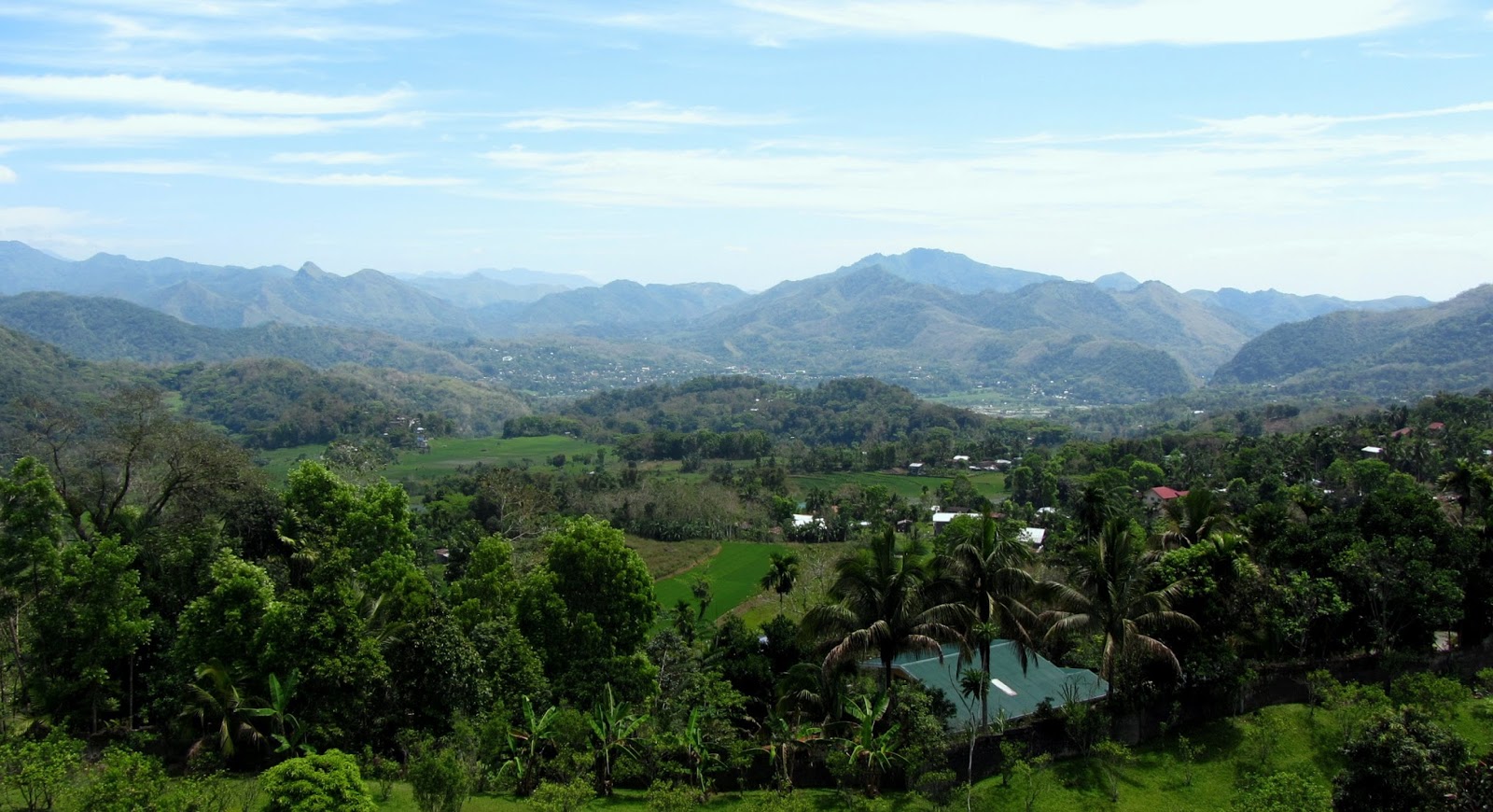
taking is on the top of the Memorial Tower where you can see the panoramic view
of Lagawe
Valley.

Also located inside the compound is the Ifugao
Museum which clearly describes the culture of the Cordillera
people and how they live independently without the need of help of the more
advance technology from advance countries or nearby cities. Inside the museum,
they showcase their old tools for daily household chores, farming, hunting,
carpentry and many others. Camera is not allowed inside so we just did our
souvenir photographs in front of the museum.

Few more shots and we bade goodbye to the
caretaker and security. Had some hydration at the nearby store and we started
traversing the bumpy road heading Tinoc, Ifugao. From Kiangan, road concreting
is on-going with only approximately 2 kilometers completed. Then after that,
all rough road terrain all the way to Tinoc.


Upon reaching Tinoc, more beautiful
vegetable plantations and terraces can be seen left and
right. I was amazed how these Cordillera natives able to curve these very steep
cliff and mountains to cultivate these kinds of land to be their source of
foods.

Past 3PM when we arrive at the town
proper of Tinoc where we took our late lunch.

Initial plan is to spend our night in this
town but since it is only 3PM, we decided to keep moving heading Kabayan,
Benguet. So after taking our lunch and few minutes of rest, we again geared up
and started rolling across the mountainous terrain and more steeper,
bumpy and rocky road heading Buguias to Kabayan, Benguet.


Only few pictures on this segment of the
ride because we are on a hurry to reach the town of Kabayan before dark,
because it will be difficult to manage some part of the terrain which is almost
technical when we get caught by darkness in the middle of the mountain. We
moved fast as much as we can and we arrived in Kabayan town proper at
past 7PM.

The lodge owner was kind enough to cook
for our dinner. Had our dinner, few bottles of beer and we ended this long and
tiring day.
==
END OF DAY 4 ==
Day 5: Kabayan, Benguet to
Taguig
Date: April 01, 2015
Route Taken: Kabayan,
Benguet – Aritao, Nueva Vizcaya – Nueva Ecija – Bulacan – Quezon City – Taguig
Today, since I need to go back to work the
next morning, I will go back to Manila ahead of my Dad as he still want to stay
longer in Kabayan to explore the town and some tourist spots. So around 7:30AM,
I left Kabayan on a solo ride going back to Manila via Aritao
and Nueva Ecija.

Very few shots on my way back to Manila
because I’m on hurry to be home early avoiding riding at night because my
headlamp got faulty again. So here are some shots, mostly on the boundaries of
each province.
Kabayan
– Bokod Boundary:

Benguet
– Nueva Vizcaya Boundary:

Nueva
Vizcaya – Nueva Ecija Boundary:

Lunch
and gas stop at San Jose, Nueva Ecija:

Some “pasalubong”
shopping in San Miguel, Bulacan:

Then continued riding and arrived home
safe before it gets dark. No long stories and sharing of road experiences and
very few pictures on this last day as it’s purely motorcycle riding going back
home.
So thank you for visiting my page again,
until here and until next time…..
==
END OF TOUR ==


You may also like:


